Contact Us Today:

 Aquila UAS only use BNUC-S™ Qualified Pilots
 Hub for Commercial UAV Operators
Get Social with Us.
Are you on our visitor map?
AquilaUAS
Follow us on:

Gallery

Use the menu on the left to navigate the individual sections
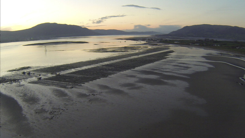
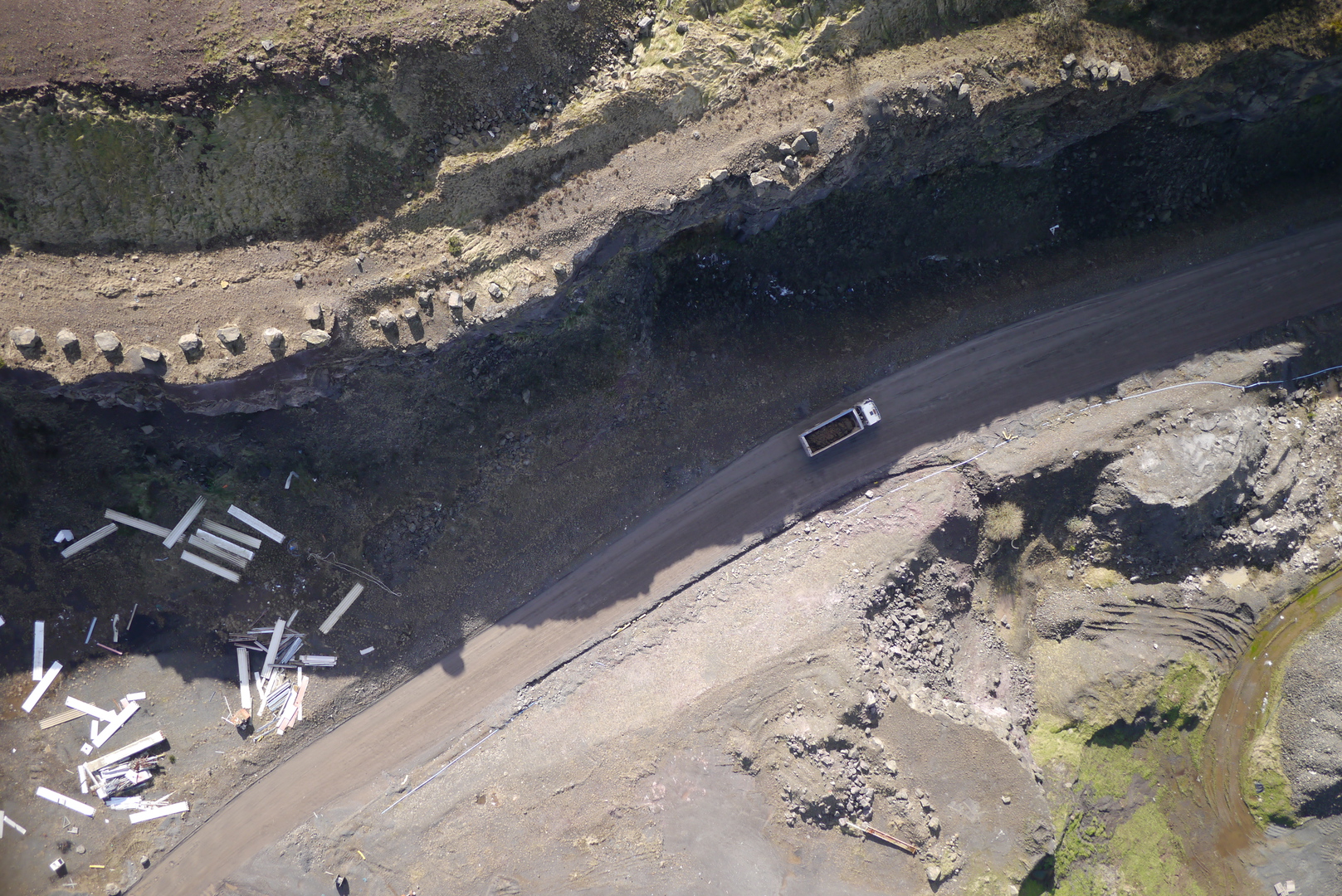
Coopers Bay, Greencastle Co. Down
Over 1100 images used to create a map of coastline from 'The Hole' to Coopers Bay at Greencastle Co. Down. Maps like these are very useful for coastline erosion study and environmental monitoring. Visible also are the Carlingford Lough oyster bags ready for collection.
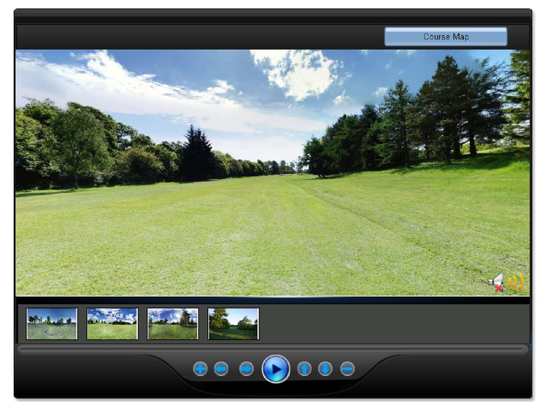
Bishopscourt Racetrack
1827 individual images were used to create this ortho-rectified final image of Bishopscourt Racetrack. This image was used as the base image for the video https://vimeo.com/106115072.
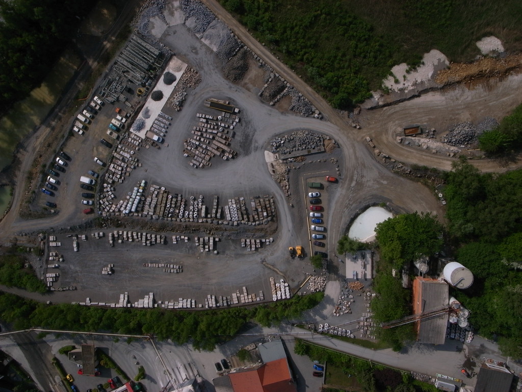
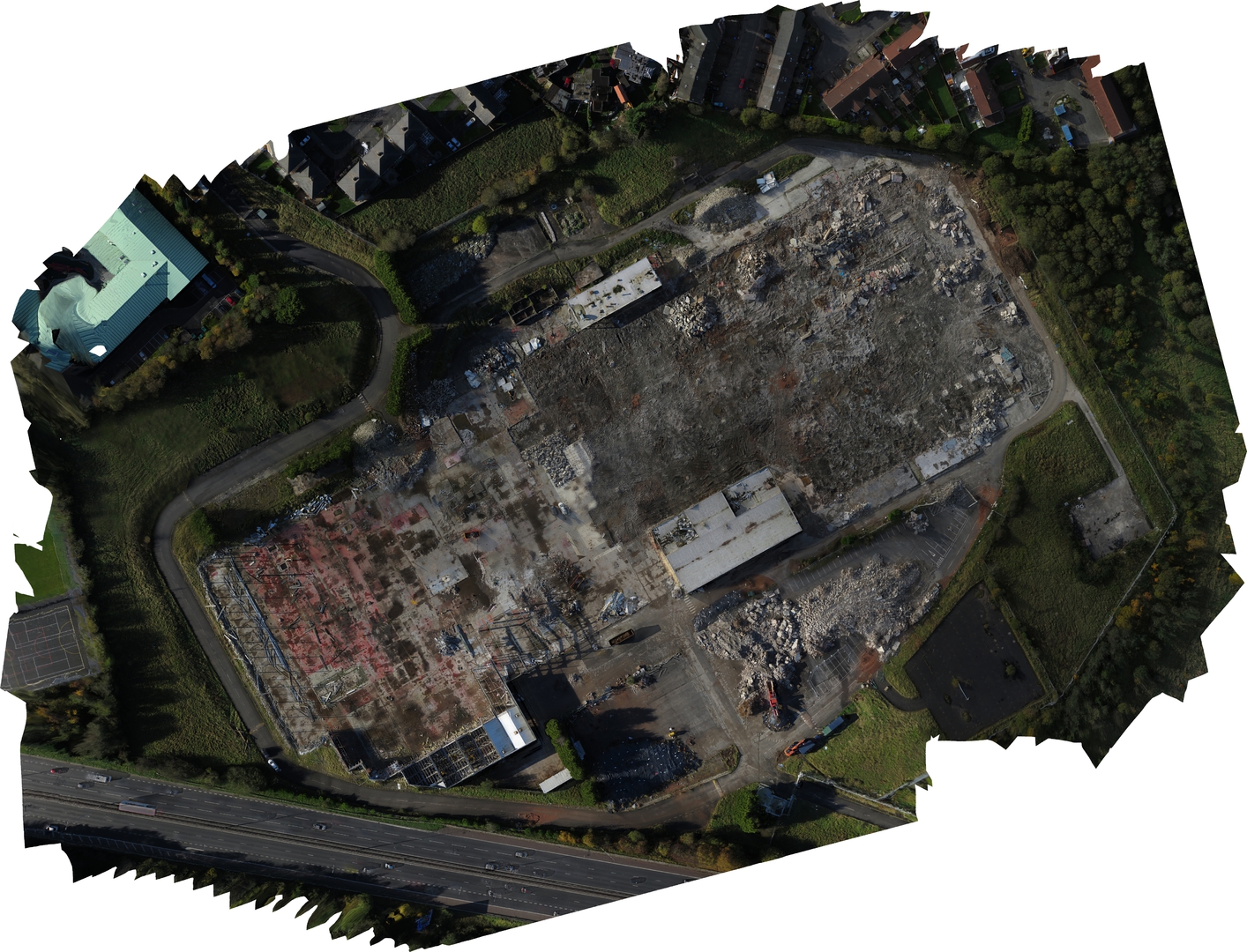
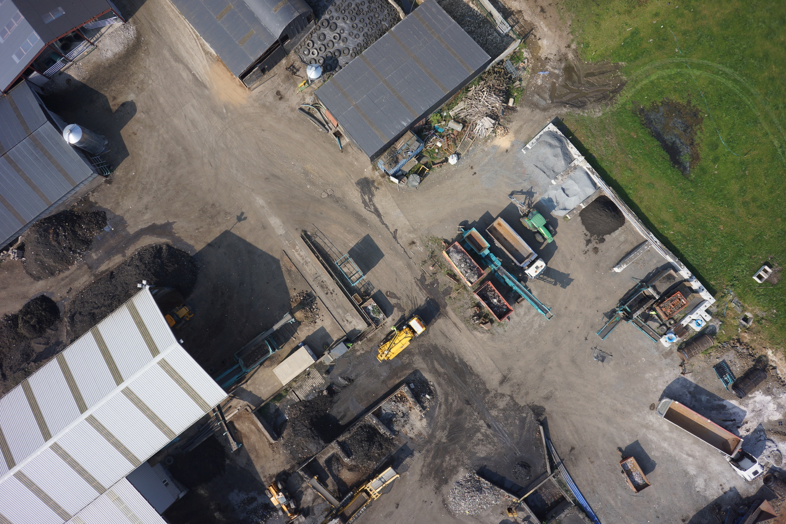
Waste Transfer Facility, Belfast Harbour
Use your mouse to nagivate around the high resolution image. 220 images were taken from a UAV & stitched together to produce the final ortho-mosaic.
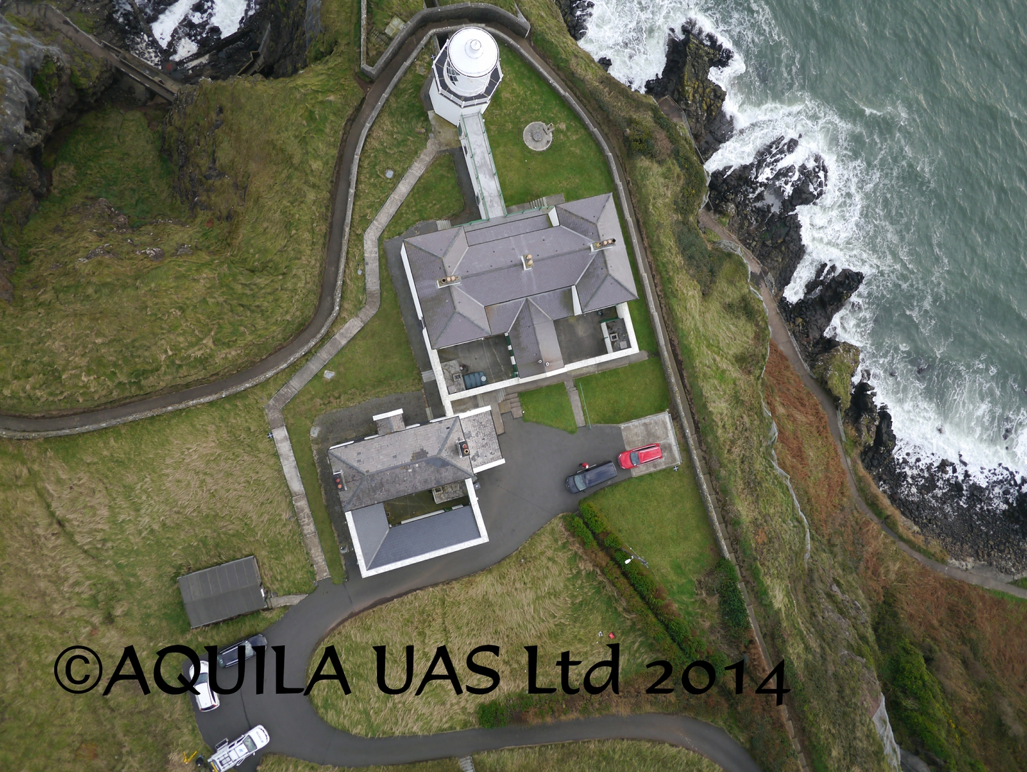
Blackhead Lighthouse near Carrickfergus Northern Ireland
Use your mouse to nagivate around the high resolution image. 400 images were taken from a UAV & stitched together to produce the final ortho-mosaic.
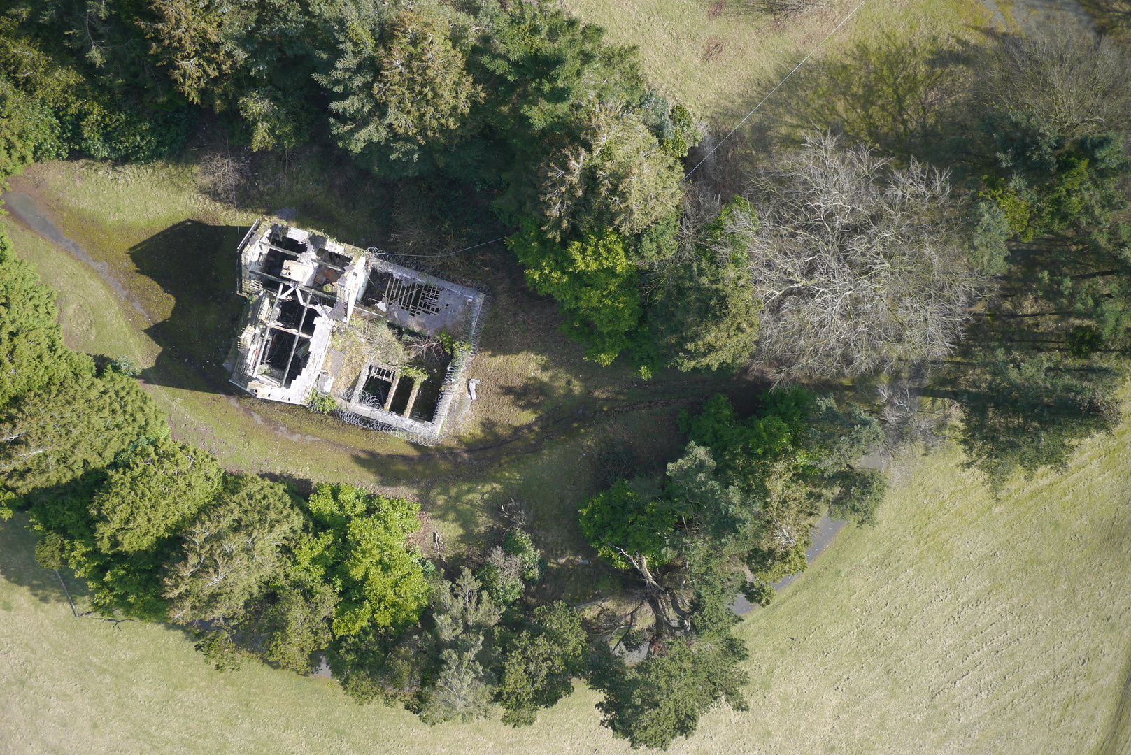
The Mourne Conduit
A 4km long section of the Mourne Conduit. The original water supplyline from The Silent Valley reservoir in the heart of the Mourne Mountains serving the Greater Belfast Area.
During the latter part of the 19th century it was recognised that Belfast would not require such an amount of water immediately, a scheme was proposed that could be developed in three stages and from there the plans for the new Mourne Water Supply Scheme were born.
Private Acts of Parliament passed in 1893, 1897 and 1899 allowed the Commissioners to purchase the necessary 9,000 acres of mountain catchment within the Mournes and acquire the appropriate wayleaves and water rights to enable Civil Engineer Macassey's scheme to get underway.
Work started almost immediately and by 1901 water from Mourne was flowing through the newly hand-built conduit, tunnels and pipeline to a new service reservoir at Knockbracken near Carryduff.
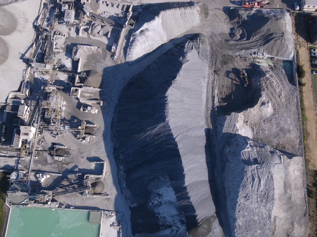
PW QUARRY ACCRA by Aquila on Sketchfab
Aquila on vimeo
Take a moment and view our videos and photographs